Decres Bay – Wittlebee Conservation Park
10km south of Ceduna, has a long sandy swimming beach, rock fishing, and bird watching. There are excellent views out to St Peters Island and visitors may be fortunate enough to watch dolphins and sea lions in the protected waters.
Located on an unsealed road.
Laura Bay Conservation Park
23km southeast of Ceduna. The Conservation Park contains a walking trail. Offers excellent swimming from sandy coves with over 100 species of bush and seabirds, mangroves and rocky headlands.
Located on an unsealed road.
Davenport Creek
Located 40km west of Ceduna and owned by the Lutheran Church, Davenport Creek is a local jewel. Travel along the Denial Bay Road for 22km and turn left onto the unsealed Davenport Creek Road. Make sure you read signage in car park regarding access to the area. It is recommended 4WD-only on beach and over the sand hills to the Davenport Creek proper. Basic toilet facilities are available with great fishing, boating and camping available. Davenport Creek is a mecca for water-loving locals and visitors alike, especially at peak times of Easter and Christmas/New Years.
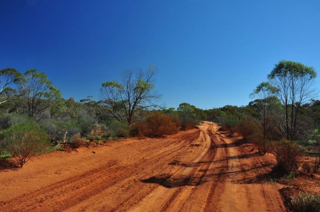
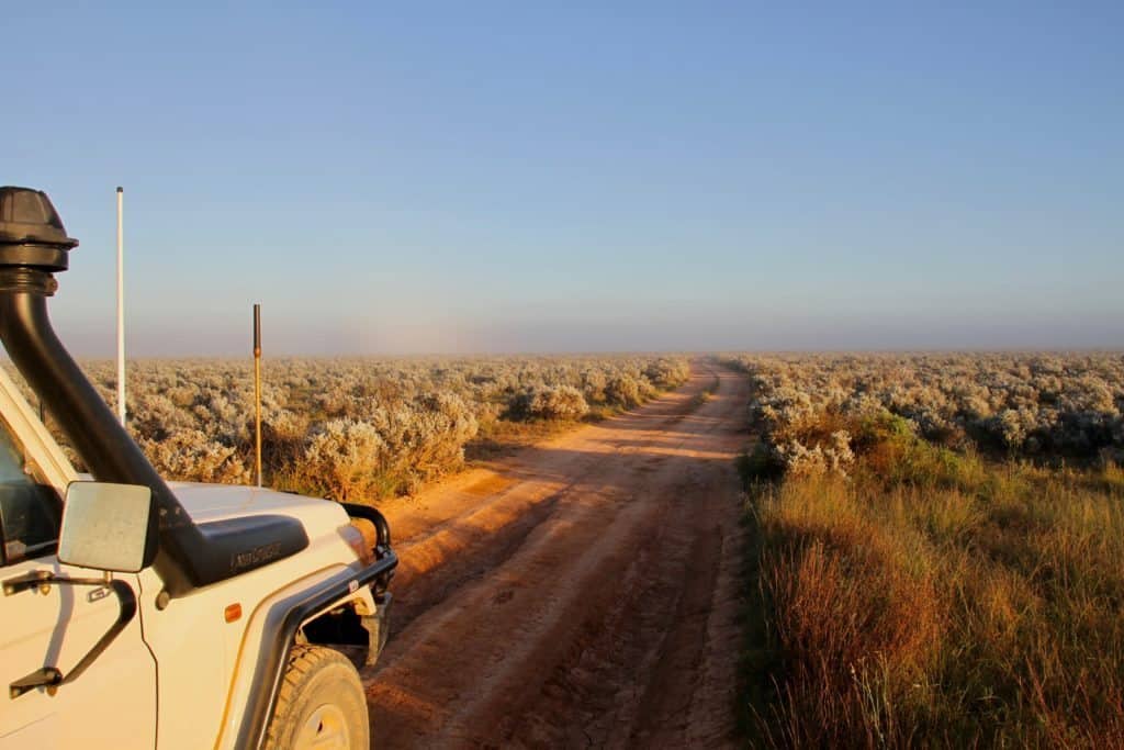
Goog’s Track (4WD only)
Sand hills, granite outcrops and dry salt lakes intrigue the visitor and locals alike. From Ceduna to the Transcontinental Railway Line is 200km. Goog’s Track starts at the Dog Fence (please shut the gate behind you and read the signs) and continues north to the first camping area, Goog’s Lake – a large, dry salt lake in a sea of sand dunes.
The other camping area is at the base of Mt Finke where from the summit, you can see an endless 360-degree view of untouched wilderness. Watch the sunset/sunrise on a sea of mallee. The park has no facilities and travellers need to be experienced and well equipped. Seek local information from the DEWNR Office or Ceduna Visitor Information Centre. This is a 4WD track only; use UHF radio Channel 18, and DEWNR recommends that no trailers be taken on the track.
Camping permits needed, and can be obtained from Ceduna Natural Resources Centre, (08) 8625 3144 or Ceduna Visitor Information Centre (08) 8625 3343.
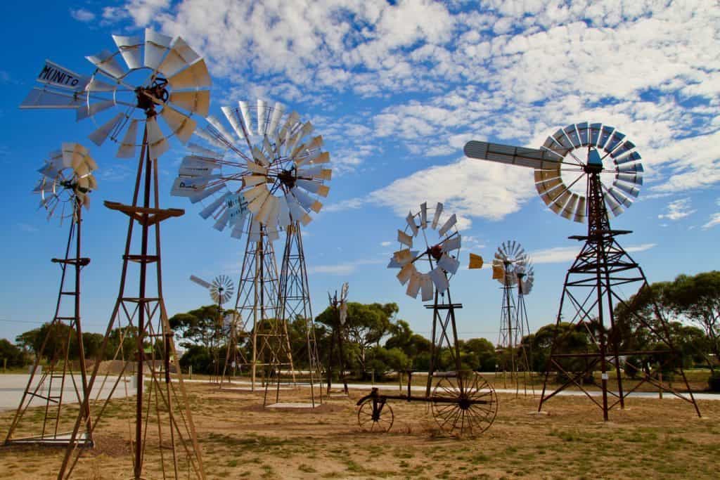
Penong
Situated 71km west of Ceduna on the Eyre Highway, the small town of Penong has 26 windmills on the eastern outskirts of the town, providing water for the area. Wells were sunk from 1868 to 1884. Each windmill is privately owned and supplies water for domestic use. Penong has a caravan park, hotel, shop, roadhouse, silo complex, a school, football clubrooms and oval.
Salt and gypsum industries complement this predominantly farming district.
Penong Windmill Museum
Opened in 2016, the Penong Windmill Museum is a showcase of old, new, small and big Windmills, including “Bruce” the biggest Windmill in Australia. Created over many years by a dedicated team of volunteers, the Museum is located just off the highway near the Caravan Park.
Follow them on Facebook!
The Woolshed Museum
The Woolshed was the first stone building in the district and was established long before there was a town. It is an evocative reminder of the past, with its arts, crafts and museum. See local artist Cindy Durant’s beautifully crafted glass slumped platters, jewellery, trays, bowls, plates and other wonderful creations.
The Woolshed is located on the Eyre Highway on the western outskirts of Penong and run by volunteers. Open Thursday to Monday each week. If not open, check in at the local general store.
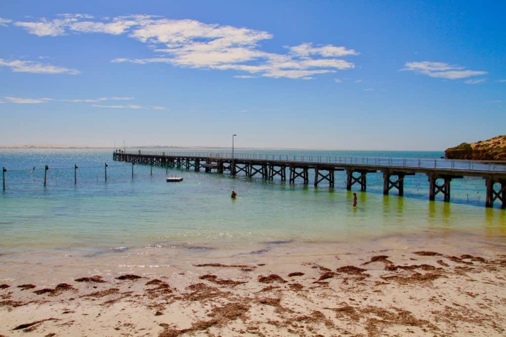
Point Sinclair and Cactus Beach
21km south of Penong. Coastal Protection Reserve, privately owned, bush camping at the park. Watch surfers at the famous Cactus Beach.
Rocky cliffs and sandy beaches allow spectators to watch the surfers from the safety of dry land. All vegetation and wildlife is protected. It is privately owned and includes Point Sinclair, both sides of the road all the way to the Blue Lake and on to the famous surf break, Caves. The owner, who resides on the property, permits camping and provides flushing toilets, rubbish bins, bore water showers and firewood.
The jetty, originally 295m long, featured a bend at the end of it, but after storm damage it was shortened to 190m in 1950 and is no longer used for shipping. It now offers a safe swimming enclosure during summer.
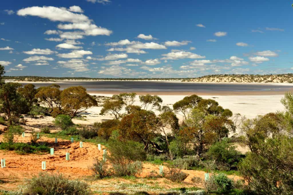
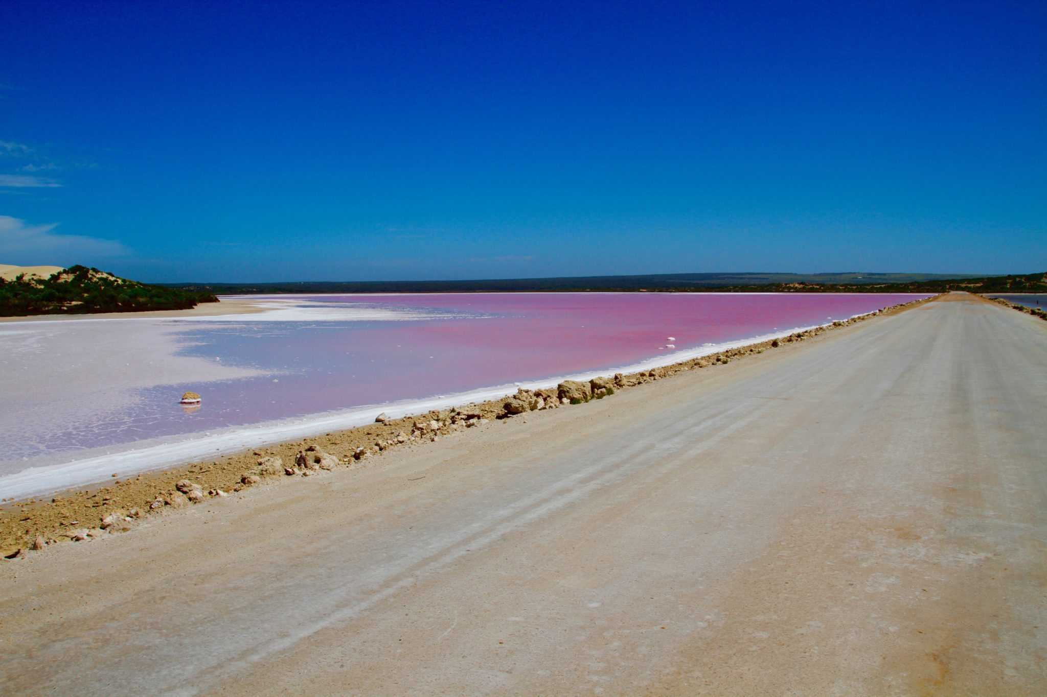
Lake McDonnell
Going to Sinclair, you drive on a causeway across Lake McDonnell, which is high in salt concentration and gives the impression of a salmon-pink lake on clear days. The lake waters may be blue in one direction and pink in another, often reflecting the white sand dunes. PLEASE NOTE – Lake McDonnell is not always pink, the vibrancy of the colour is dependent on water levels.
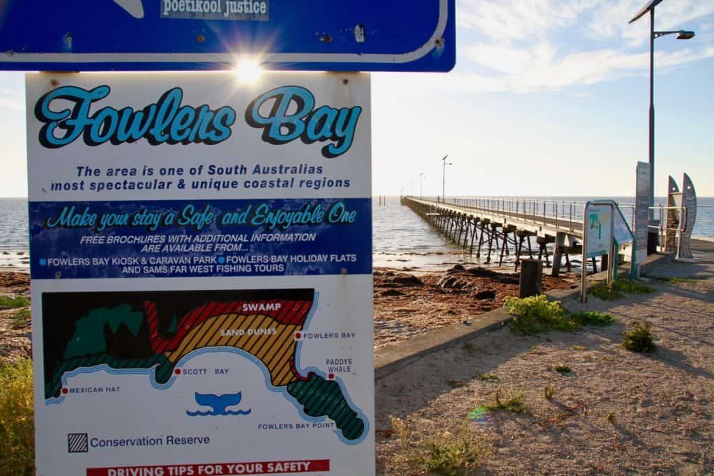
Fowlers Bay
140km west of Ceduna. The major Fowlers Bay signage is now on one road into Fowlers Bay. This is a new road that has 15km of sealed road and 7km of dirt road.
With a permanent population of only 16 people this fishing and holiday destination boasts some wonderful attractions. A solar-lit jetty (300m long), caravan park, kiosk and holiday units.
Fowlers Bay is a great place to stay for the whale season from June to October. Mulloway and salmon fishing from October to March. Stop to have a look at fabulous sand hills, coastal views, rugged cliffs, the old whaling station remnants and the old Yalata Homestead and station ruins.
Nundroo
152km west of Ceduna. Nundroo is a service point for the traveller and now consists of a hotel/motel, caravan park, and roadhouse open 8am to 11pm. Also a major mechanical repair service, cabin park and holiday units.
The Dog Fence
One of the longest continuous fences in the world built to keep wild dingoes out of pastoral lands. The Dog Fence is 5,614kms long, starts in Queensland and extends to the Great Australian Bight in SA.
Between Nundroo and Yalata on the Eyre Highway you will cross a grid on the road; this is part of the dog fence.
Yalata
203km west of Ceduna. No longer has a roadhouse or facilities for the traveller. Permits are required to camp on Yalata land.
Head of Bight
Head of Bight, approximately 290km west of Ceduna, becomes the playground for migrating southern right whales during the months of June to October. Turn down a sealed road to the Interpretive Centre and viewing platforms (13km).
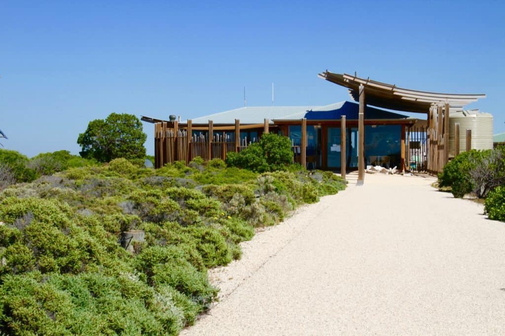
The Interpretive Centre is open from 8am to 5pm daily during the whale season.
Situated on the Aboriginal Lands, this is one of the best viewing areas in the world with more than 100 whales, including calves, congregating in the seas adjacent to the Bunda cliffs.
Interpretive Centre facilities at Head of Bight include toilets, sheltered information gazebo, walkways and large viewing platforms.
We suggest taking a hat, sunscreen, drinking water, binoculars, cameras and a jacket. Throughout the whale-watch season, extremes of climate are often experienced. Being prepared will ensure a more pleasant experience.
Nullarbor Roadhouse
297km west of Ceduna. Nullarbor is a service point for the traveller and now consists of a roadhouse, motel, restaurant and caravan park. Open 7am to 11pm.
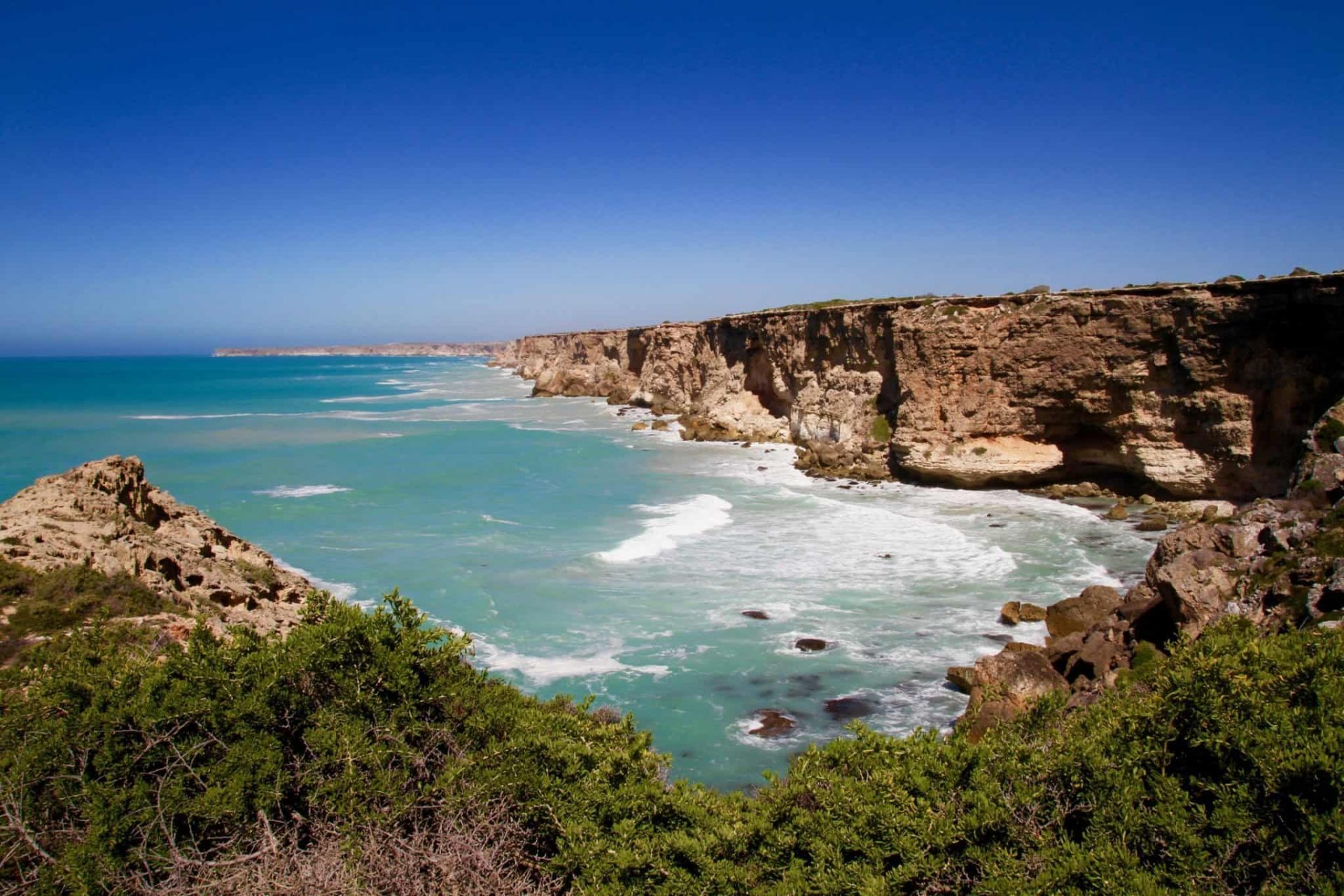
The Nullarbor Bunda Cliffs stretch unbroken for 209km from the Head of the Bight to Wilson’s Bluff at the Western Australian border and plummet 90m into the Southern Ocean. Viewing areas provide spectacular vistas along this majestic coastline.
Chinta Air are available for joy flights over the area during the whale season from the Nullarbor Roadhouse.
Nullarbor Wilderness Protection Area
The Nullarbor National Park adjoins the Great Australian Bight and extends inland. This park encompasses some 2,867,000 hectares from Nullarbor Roadhouse to the WA border and north to the Transcontinental Railway Line. The Eyre Highway passes through the coastal areas of the Park.
WA/SA Border Village
482km west of Ceduna. Consists of a roadhouse, motel, restaurant and caravan park (24-hour). A giant red kangaroo named Rooey 11 presides over the Border Village, which also boasts a fantastic signpost to many parts of the world.
Quarantine Check Point
Situated on the WA and SA border just after Border Village. Quarantine WA Phone: (08) 9039 3277.
Please remember to change your clocks on the WA/SA border. Across the border into Western Australia, the next service point for the traveller is Eucla, just 13km down the road.
Heading South-East from Ceduna?
Explore the rest of the Eyre Peninsula, starting with our nearest neighbours in Streaky Bay, then continue south to Elliston, Coffin Bay and Port Lincoln or east to Wudinna, Kimba and Whyalla.
Use these resources to help you plan your trip:
- Eyre Peninsula’s visitor information website
- Streaky Bay’s visitor information website
- Elliston’s visitor information website
- Coffin Bay’s visitor information website
- Port Lincoln’s visitor information website
- Whyalla’s visitor information website
See Also
- Attractions in Ceduna
- Tours & Charters from Ceduna
- Nullarbor Links – The World’s Longest Golf Course
- Day Drives from Ceduna